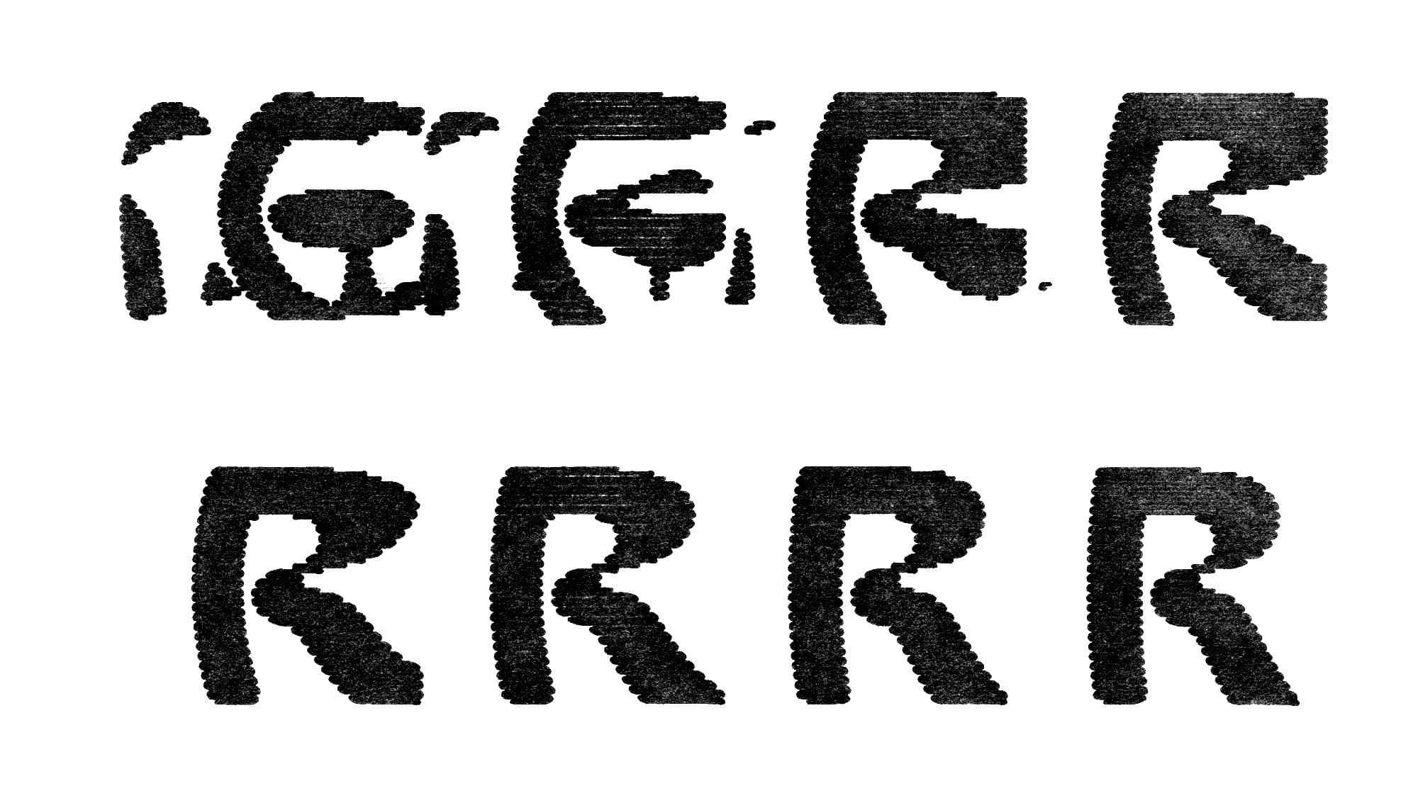
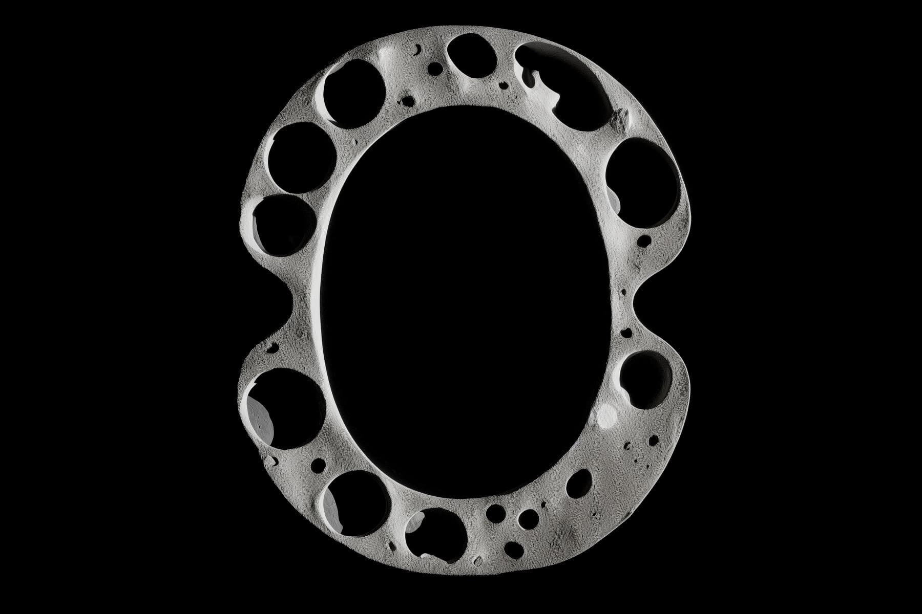
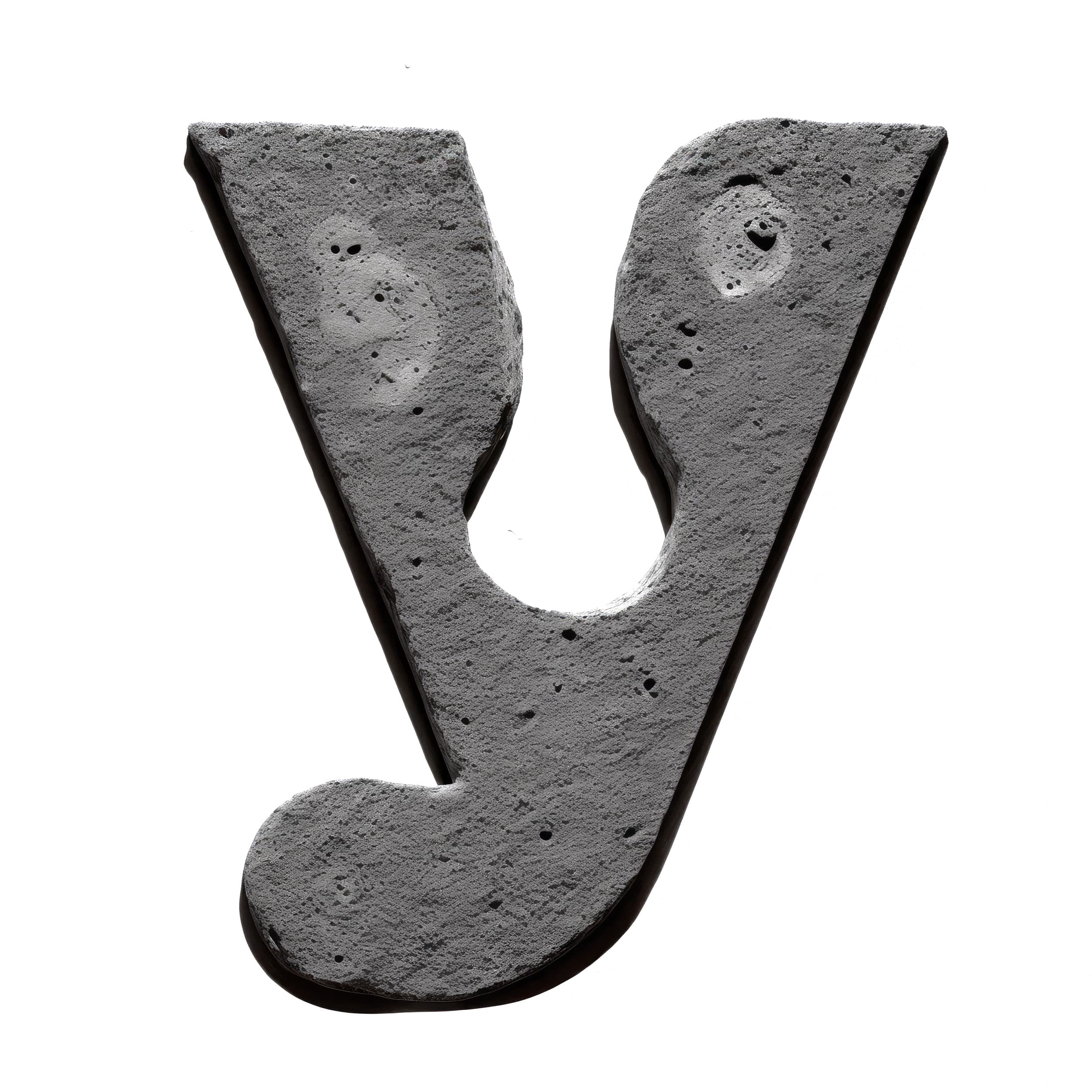
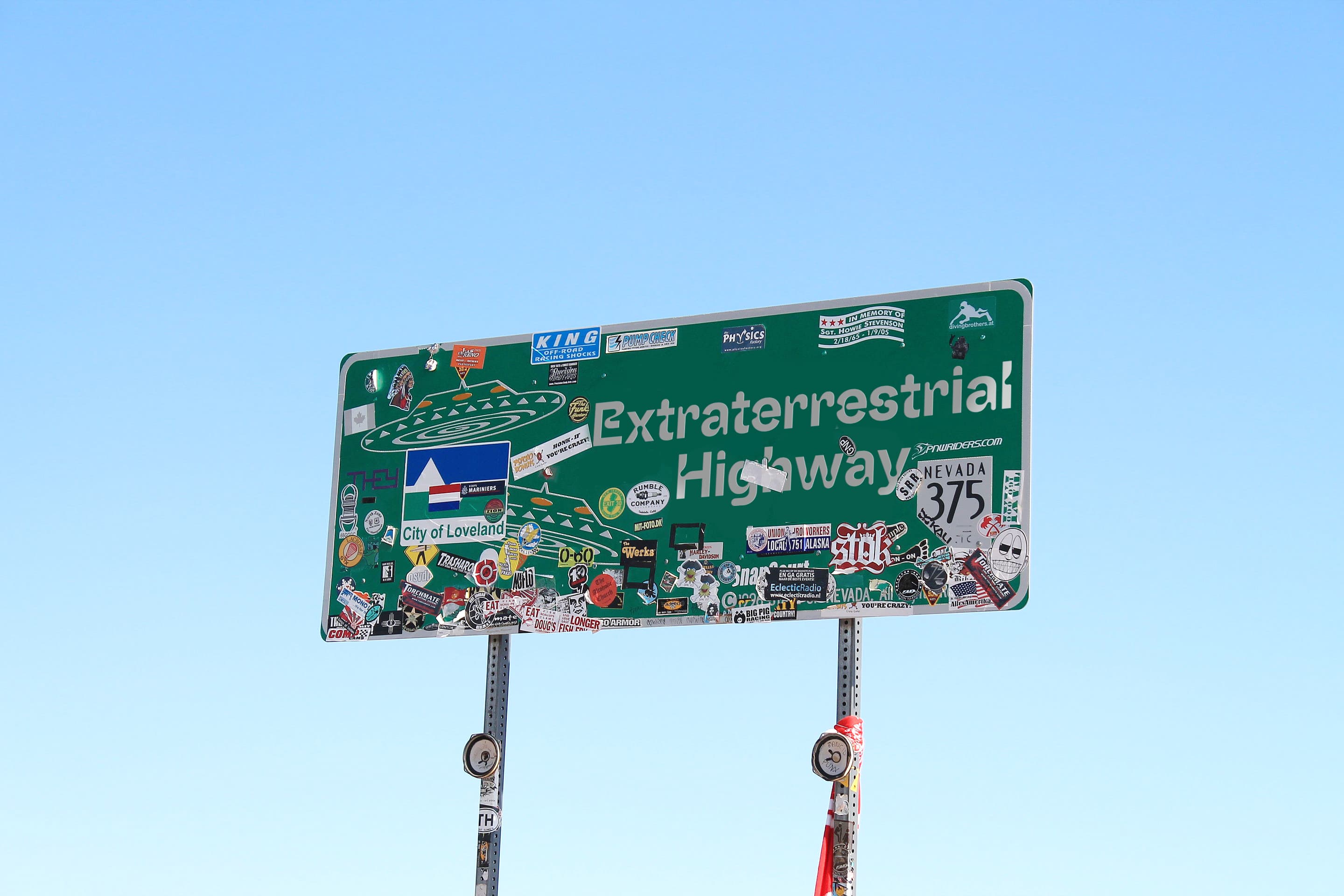
Raum

THE APOLLO PROGRAM, also known as Project Apollo, was the United States human spaceflight program carried out by the National Aeronautics and Space Administration (NASA), which succeeded in preparing and landing the first men[2] on the Moon
Apollo ran from 1961 to 1972, with the first crewed flight in 1968. It encountered a major setback in 1967 when an Apollo 1 cabin fire killed the entire crew during a prelaunch test. After the first successful landing, sufficient flight hardware remained for nine follow-on landings with a plan for extended lunar geological and astrophysical exploration. Budget cuts forced the cancellation of three of these. Five of the remaining six missions achieved successful landings, but the Apollo 13 landing had to be aborted after an oxygen tank exploded en route to the Moon, crippling the CSM. The crew barely managed a safe return to Earth by using the lunar module as a "lifeboat" on the return journey.
NASA's subsequent human spaceflight capability and funded construction of its Johnson Space Center and Kennedy Space Center. Apollo also spurred advances in many areas of technology incidental to rocketry and human spaceflight, including avionics, telecommunications, and computers.
AAAAAAA BBBBBBB CCCCCCC DDDDDDD EEEEEEE FFFFFFF GGGGGGG HHHHHHH IIIIIII JJJJJJJ KKKKKKK LLLLLLL
MARE VAPORUM or the Sea of Vapors is a lunar mare located between the southwest rim of Mare Serenitatis and the southeast rim of Mare Imbrium. It was named by Giovanni Battista Riccioli in 1651.
The Gazetteer of Planetary Nomenclature website is maintained by the USGS Astrogeology Science Center. This work is performed on behalf of the International Astronomical Union's Working Group for Planetary System Nomenclature and is supported by the National Aeronautics and Space Administration under an Interagency Agreement.
Mare Nectaris is located in the central part of 860-km-diameter impact basin, which was formed 3.8–3.9 billion years ago. This event marks the beginning of Nectarian period of the lunar geologic timescale. The best-preserved part of the rim of this basin is called Rupes Altai, in the southwest part of the basin, Lava filling of Mare Nectaris is younger than the basin itself. The mare material is approximately 1000m in depth, and mainly of the Nectarian period and the Lower Imbrian epoch, with the mare material of the Upper Imbrian epoch. The crater Theophilus on the northeastern side of the mare is of the Eratosthenian period. Thus, the crater is younger than the mare to its southeast. Enough subsidence has occurred to open a few arcuate grabens on the western margin of the mare.

The Lunar Orbiter program was a series of five uncrewed lunar orbiter missions launched by the United States in 1966 and 1967. Intended to help select Apollo landing sites by mapping the Moon's surface,[1] they provided the first photographs from lunar orbit and photographed both the Moon and Earth.
Fracastorius is the lava-flooded remnant of an ancient lunar impact crater located at the southern edge of Mare Nectaris. To the northwest of this formation lies the crater Beaumont, while to the northeast is Rosse. The northern wall of this crater is missing, with only mounds appearing in the lunar mare to mark the outline. The lava that formed Mare Nectaris also invaded this crater, so the structure now forms a bay-like extension.
Catena Abulfeda is a chain of craters on the Moon that runs between the southern rim of the crater Abulfeda and the north rim of Almanon, then continues for a length of 210 kilometers across the Rupes Altai. It is located at 16.9°S 17.2°E. This crater chain is the best known feature of its type on the Moon. It consists of a linear string of 20 impact craters ranging in size from 1 to 3 km in diameter. The largest, Almanon C, is positioned near the middle of the chain. The sides of the valley rise from the floor to the surrounding highland terrain, a blocky, irregular surface. The southern face of the valley is straighter than the northern side, which is slightly bowed and uneven. The more rugged edges of the valley lie at the narrow west-southwest end that cuts through the mountain range.


MONS GRUITHUISEN Gamma is a lunar dome that lies to the north of the crater Gruithuisen at the western edge of the Mare Imbrium. This massif is shaped as a rounded dome in the surface
The Gruithuisen domes differ from typical mare domes in that they're more mountain-like in their proportions, with a higher albedo and a rougher surface texture. The lava they're composed of might be the key to why they're different. It's thought to have a higher silica content, making it thicker, slower moving and faster cooling, enabling it to pile up into these structures. Such silicic volcanism is rare on the Moon, and it's still unclear how it can occur there at all, as on Earth it requires the presence of water and plate tectonics - factors absent on the Moon. This makes the region a compelling target for exploration.
- This is not a list of the highest places on the Moon, meaning those farthest from the CoM. Rather, it is a list of peaks at various heights relative to the relevant datum. This is because the Moon has mass asymmetries: the highest point, located on the far side of the Moon, is approximately 6,500 meters higher than Mons Huygens (usually listed as the tallest mountain). Mons Esam is a small, isolated mountain in the northern part of the Mare Tranquillitatis. It is located to the southeast of the crater Vitruvius and to the west-northwest of Lyell. To the northeast of this ridge is the bay called Sinus Amoris.
MMMMMMM NNNNNNN OOOOOOO PPPPPPP QQQQQQQ RRRRRRR SSSSSSS TTTTTTT UUUUUUU UUUUUUU VVVVVVV WWWWWWW XXXXXXX YYYYYYY ZZZZZZZ
rafys
- rafys
Mons Herodotus is a small lunar mountain north of the crater Herodotus. It lies on the rugged ARISTARCHUS PLATEAU and rises approximately 1 km above the surrounding terrain.
A solitary mountain chain in the eastern Mare Imbrium of the Moon. It is located about 80 km to the north of the flooded crater Archimedes. The range trends from south to north, consisting of a number of peaks separated by lava-flooded valleys, and has a maximum width of about 25 km. It is thought to be the surviving rim or inner ring of an impact crater that has been buried under magma flows.
COPERNICUS is a lunar impact crater located in eastern Oceanus Procellarum. It was named after the astronomer Nicolaus Copernicus. It typifies craters that formed during the Copernican period in that it has a prominent ray system. It may have been created by debris from the breakup of the parent body of asteroid 495 Eulalia 800 million years ago. Copernicus is visible using binoculars, and is located slightly northwest of the center of the Moon's Earth-facing hemisphere. South of the crater is the Mare Insularum, and to the south-south west is the crater Reinhold.
0000000
Oceanus Procellarum was formed by ancient volcanic eruptions resulting in basaltic floods that covered the region in a thick, nearly flat layer of solidified magma.
The rays are less distinct than the long, linear rays extending from Tycho, instead forming a nebulous pattern with plumy markings. In multiple locations the rays lie at glancing angles, instead of forming a true radial dispersal. An extensive pattern of smaller secondary craters can also be observed surrounding Copernicus, a detail that was depicted in a map by Giovanni Cassini in 1680.
...a hummocky crater rim, numerous large slump blocks on the crater wall, and a complex of central peaks. Sets of parallel fractures, aligned with the lunar structure grid, formed after the crater wall took its present form, but before the smoothest floor materials were emplaced. The smooth floor materials show a swirling pattern of cracks like those seen on terrestrial lava flows. These materials are associated with numerous hills that have summit craters and are probably small volcanoes. Several low places on the rim and wall are partly filled by what appears to be ponded volcanic material, or possibly fluidized impact debris.
vvvvvvv
Areography, also known as the geography of MARS, is a subfield of planetary science that entails the delineation and characterization of regions on Mars.
During the planet's great opposition of 1877, he observed a dense network of linear structures on the surface of Mars, which he called canali in Italian, meaning "channels", but the term was mistranslated into English as "canals".
Later, with notable thanks to the observations of the Italian astronomer Vincenzo Cerulli, scientists came to the conclusion that the famous channels were actually mere optical illusions. The last popular speculations about canals were finally put to rest during the spaceflight era beginning in the 1960s, when visiting spacecraft such as Mariner 4 photographed the surface with much higher resolution than Earth-based telescopes, confirming that there are no structures resembling "canals".

MENOS
- MENOS
Hauss & Raum define distinctive polarities from the purely utilitarian to the bombastically deontological–a sturdy design tool and an exercise in psychedelic retrofuturism. While Hauss is Sloane’s meticulous creation, crafted over years of trial and refinement for his own graphic design practice, Raum represents a sort of destruction–pushing the contemporaneous “display inktrap” motif into uncharted territory.